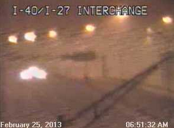
A full fledged blizzard is underway in the Texas/Oklahoma panhandle this morning. This was the scene in Amarillo shortly before 7 a.m. today:
Winds are gusting 55-60 mph and the NWS has measured 11 inches of snow with 2 foot drifts at the office about 7 miles East of the city.
Similar conditions are in place across most of the Texas panhandle and into the Oklahoma panhandle as well. TX DOT has suspended operations and have advised citizens to regard all major roadways as closed/impassable.
Blizzard conditions are developing in extreme northwest Oklahoma and southern Kansas as well, and such conditions will develop and increase East/Northeastward throughout the day...
The latest watch/warning/advisory map is shown above. Orange = Blizzard Warning, pink = Winter Storm Warning, purple = Winter Weather Advisory, blue-grey = Winter Storm Watch.
Stay tuned for more...and be sure to follow me on facebook and twitter for additional, more frequent updates...
For more information from 'The Original Weather Blog', including shorter, more frequent posts during rapidly changing weather events, please be sure to follow me on facebook and twitter:
Coming March 2013: The Tornado Chronicles full website!
• Interactive tornado database back to 1950 (earlier years coming soon)
• Interactive radar with live warnings and street-level zoom
• Tornado safety, preparedness and education
• Daily tornado outlooks/threat index
• Photos, videos & more!
Please show your support and follow The Tornado Chronicles on twitter and on facebook for the latest updates on tornadoes and the upcoming website!


0 comments:
Post a Comment